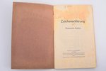
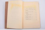
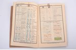
set, map Durchgangsstraßen Blatt Westdeutschland (Road Map of West Germany, 1941), scale 1:1,000,000, marked "nur für den dienstgebrauch!" (For official use only), and Zeichenerklärung für Russische Karten (Explanation of Symbols for Russian Maps, 1942), Germany, 1941-1942, 86 x 120 cm, some tears along folding lines, missing map fragment
| printed work form: | set |
|---|---|
| title: | map Durchgangsstraßen Blatt Westdeutschland (Road Map of West Germany, 1941), scale 1:1,000,000, marked "nur für den dienstgebrauch!" (For official use only), and Zeichenerklärung für Russische Karten (Explanation of Symbols for Russian Maps, 1942) |
| country: | Germany |
| language: | german |
| year of impression: | 1941-1942 |
| dimensions: | 86 x 120 |
| additional information: | some tears along folding lines, missing map fragment |
Fill in this form to ask site administration question about this item
* Required fields
* Required fields