

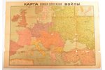
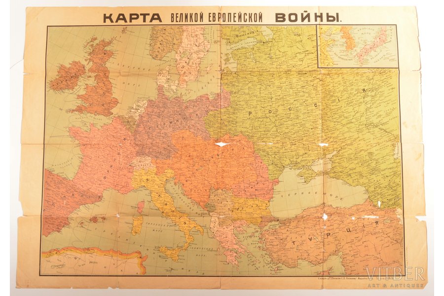
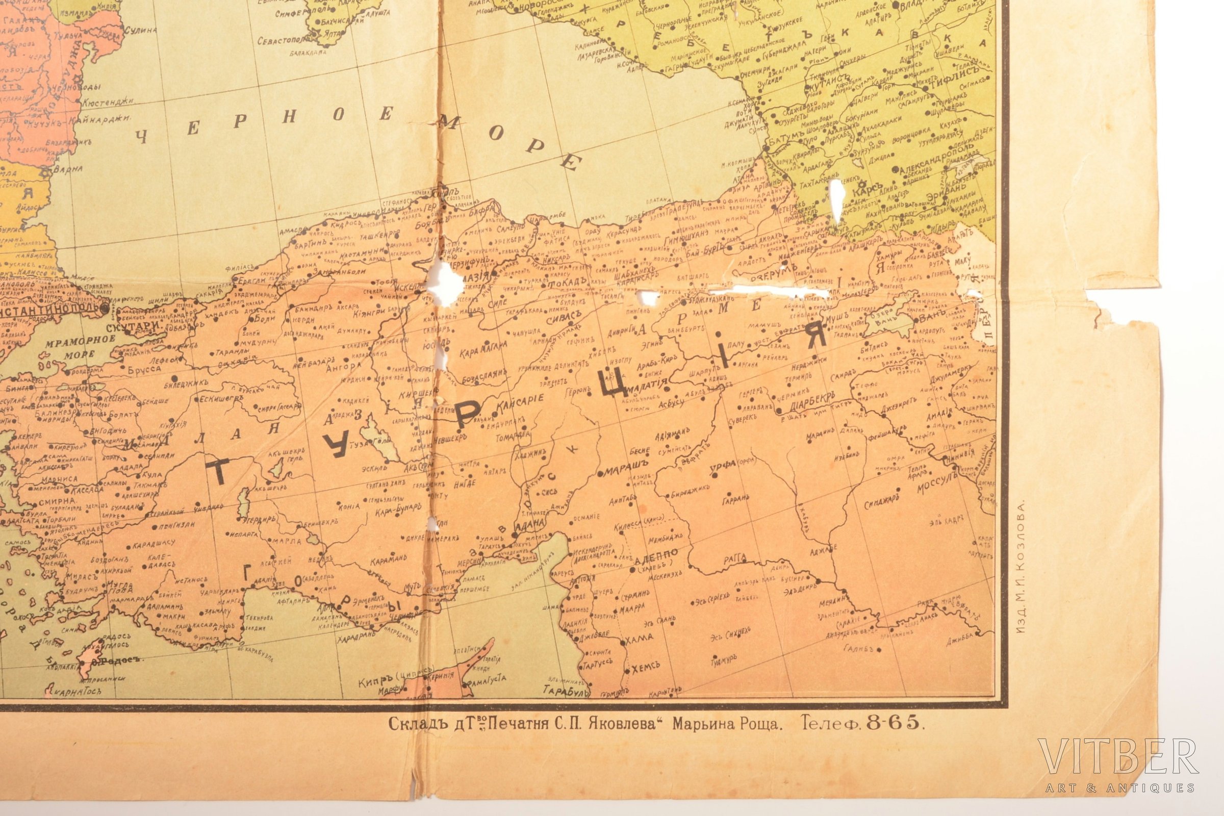
map, "The map of Great European War", Russia, beginning of 20th cent., 79.4 x 111.8 cm, publisher M.I. Kozlov, map is torn on the folding lines and on the edges, pencil marks
| printed work form: | map |
|---|---|
| title: | "The map of Great European War" |
| country: | Russia |
| language: | russian |
| period of impression: | beginning of 20th cent. |
| dimensions: | 79.4 x 111.8 |
| additional information: | publisher M.I. Kozlov, map is torn on the folding lines and on the edges, pencil marks |
Fill in this form to ask site administration question about this item
* Required fields
* Required fields